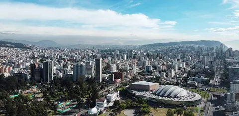
The monument commemorates a scientific expedition that measured the shape of the Earth, not the equator itself. Seen that way, a 240-metre gap is a footnote in the history of surveying rather than a hoax. You can still enjoy the complex, but you should decide in advance whether you also want a photo on the satellite-measured line.
Is the Mitad del Mundo monument on the real equator?
Not by modern measurement. The Prefectura de Pichincha's article on the "true" middle of the world gives the monument's position as 0°0'7.83" south, 240 metres south of the equatorial line. The Museo Solar Quitsato, which runs its own equator site, publishes nearly the same figure: 7.7 seconds south of the zero parallel, around 240 metres.
The arithmetic checks out. One degree of latitude near the equator is about 110.6 km, so one arc-second is roughly 30.7 metres. Multiply by 7.8 seconds and you get about 240 metres.
The operator itself still presents the site as "latitud 0°0´0"" on its home page, and its institution page credits Charles-Marie de La Condamine with determining the equatorial line in the 18th century. Treat that as the complex's traditional framing. The painted line you will photograph there is a symbol of the mission's work.
Why is the monument about 240 metres off?
The expedition was measuring the Earth, not drawing a line
According to a paper by François Le Tacon and Jean-Louis Rivail for the Académie de Stanislas, the expedition left La Rochelle on 16 May 1735 to settle an argument: was the Earth flattened at the poles, as Newton predicted, or elongated, as the Cassini school held? Louis Godin, Pierre Bouguer and La Condamine, joined by the Spanish officers Jorge Juan and Antonio de Ulloa, measured a meridian arc of about three degrees between Quito and Cuenca from 1736 to 1742.
Their result, around 56,750 toises per degree near 1°30' south, compared with 57,438 toises from a parallel expedition to Lapland. A degree was longer in the far north, which confirmed polar flattening. The equator ran through their survey area, but pinning it to the metre was never the goal.
Two monuments, two centuries later
Pichincha's page on Mitad del Mundo says the first monument, 10 metres tall, was built in 1936 by the geographer Luis Tufiño. Quitsato describes Tufiño as the director of the Quito Astronomical Observatory who positioned it.
The present 30 m monument, topped with a metal globe, went up in San Antonio de Pichincha parish. Pichincha dates it to 1979; Quitsato gives 1982. We could not settle the year from a single primary record, so read it as "completed around 1979 to 1982".
How a measured latitude can shift
No official Ecuadorian page we read names one technical cause for the gap. Pichincha states only that the offset could be confirmed after civilian GPS use was established in 1996.
General geodesy explains how such gaps arise. The US National Geodetic Survey's Geodesy for the Layman notes that latitude found by astronomical observation follows the local plumb line, while survey and GPS latitudes refer to a mathematical ellipsoid. The angle between the two, the deflection of the vertical, makes astronomic and geodetic latitudes differ. The same point can also carry different coordinates on different survey datums. In the Andes, with large mountain masses nearby, a pre-satellite observation and a GPS reading need not agree.
Where can you stand on 0°0'0" near Quito?
Pichincha lists five markers and how far each sits from the line. Only two are placed on it.
| Site | Position given by Pichincha | Suits |
|---|---|---|
| Ciudad Mitad del Mundo, San Antonio de Pichincha | 0°0'7.83" S, about 240 m south | Museums, planetarium, the classic monument photo |
| Guachalá sphere | 0°0'7" S, about 210 m south | A roadside stop only |
| 1936 monument, Calacalí town park | 0°0'1" N, about 30 m north | History fans; the original marker |
| Quitsato sundial, Cayambe | 0°0'0" | Standing on the line with an explanation |
| Cerro Catequilla | 0°0'0" | Pre-Inca site; we found no official visiting rules |
Quitsato's sundial is a platform 54 m across with a 10 m central gnomon, according to the museum. The museum opened on 21 June 2007 at Panamericana Norte E35, km 192, in the Guachalá sector of Cayambe. The museum's own interpretation focuses on solar astronomy and the Andean cultures of the zero latitude.
Planning either visit
Ciudad Mitad del Mundo
The operator lists opening hours and fees: Monday to Friday 9:00 to 17:00, weekends 9:00 to 18:00, with adults at USD 5.00 and children and seniors at USD 2.50. The page does not show a separate foreigner rate, age cut-offs, or what each ticket includes, so ask at the ticket office whether the monument's interior museum and the planetarium are covered on the day. Payment is in US dollars; our guide to Ecuador's dollars and coins covers small change and large notes.
Inside, the experiences page describes a nine-floor museum in the monument covering Ecuador's regions and peoples, plus a France Pavilion on the geodesic missions. The pavilion is where the history in this article is told on site.
For getting there, Pichincha estimates about 45 minutes by private vehicle and 1 to 1.5 hours by public transport, including a Metrobús from La Ofelia station of about 25 minutes.
Quitsato
Quitsato's visit page lists opening hours of 8:30 to 17:30 daily, last entry 30 minutes before closing. Adults pay USD 5; children under 12, seniors and people with disabilities pay USD 3. By bus, the museum directs visitors to the Flor del Valle cooperative towards Cayambe from La Ofelia station, about 1 hour 20 minutes, getting off at "La Bola de Guachalá". By car it gives around 48 minutes.
A quick time check before you commit to both in one day: using the official estimates, public transport means up to 1.5 hours each way to Ciudad Mitad del Mundo and about 1 hour 20 minutes each way to Quitsato, via La Ofelia both times. That is up to about 5 hours 40 minutes of travel before any sightseeing, with Quitsato's last entry at 17:00. With a single free day and no car, pick one site; with a driver, both become realistic.