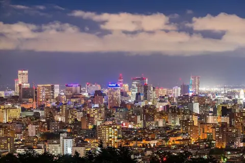
Sapporo's grid did not start at Odori Park, and not every "jo" address in the city counts from downtown. The 1871 layout used what is now Minami 1-jo street and the Sosei River as its base lines, and districts such as Kotoni (琴似) and Hiragishi (平岸) have jo-chome grids of their own.
This guide explains how to read a Sapporo address, where the grid comes from, and where the system stops being a simple coordinate. It draws on Sapporo City's pages on addresses and place names, the Chuo Ward office's history pages and the Sapporo Tourist Association, all read on 23 September 2026.
Reading a jo-chome address
A downtown Sapporo address has four parts: a direction and a jo number, then a direction and a chome number. Kita 1-jo Nishi 2-chome (北1条西2丁目), the official address of Sapporo City Hall, is the example used throughout this guide.
The first half places you north or south. Kita (北) means north and Minami (南) means south, and the jo (条) number is the row counted away from Odori Park, so Kita 1-jo is the first row north of the park and Minami 1-jo the first row south of it.
The second half places you east or west. Nishi (西) means west and Higashi (東) means east, and the chome (丁目) number counts blocks away from the Sosei River (創成川), so Nishi 2-chome is the second block west of the river.
Odori Park itself has its own names. Sapporo City's list of current town names in Chuo Ward includes Odori Nishi 1 to 28-chome (大通西) and Odori Higashi 1 to 14-chome (大通東), so an address on the park strip reads "Odori Nishi" plus a chome number, with no jo.
| Name | Local name | What it is | Price range |
|---|---|---|---|
| Kita | 北 | North of Odori Park | No fee stated |
| Minami | 南 | South of Odori Park | No fee stated |
| Nishi | 西 | West of the Sosei River | No fee stated |
| Higashi | 東 | East of the Sosei River | No fee stated |
| Jo | 条 | Row number counted north or south | No fee stated |
| Chome | 丁目 | Block number counted east or west | No fee stated |
| Banchi | 番地 | Land lot number, used where residence numbering is not in force | No fee stated |
| Ban / go | 番 / 号 | Block and building numbers under residence numbering | No fee stated |
| Residence numbering | 住居表示 | System of building numbers introduced nationally in 1962 | No fee stated |
| Block plate | 街区表示板 | White 66 cm sign with green lettering on corner buildings | Reissue free |
| House number plate | 住居番号表示板 | Navy 7 x 12 cm plate with white numbers | Reissue free |
The numbers can run high. The Chuo Ward list goes as far as Minami 30-jo Nishi and Kita 22-jo Nishi, and the lists for neighbouring wards continue the northern rows to Kita 40-jo Nishi in Kita Ward and Kita 51-jo Higashi in Higashi Ward.
The coordinates run across ward boundaries. Chuo Ward's list starts Kita 6-jo Nishi at 10-chome, while Kita Ward's list has Kita 6-jo Nishi 1 to 9-chome, so the same grid continues and the ward name in front of the address tells you which side of the line you are on. The eastern rows work the same way, with Kita 4-jo and 5-jo Higashi split between Chuo and Higashi wards.
The lists also have gaps. Chuo Ward's list skips Nishi 19-chome for Minami 3-jo to Minami 13-jo, running from 18-chome straight to 20-chome, and the city's page gives no reason, so do not assume every number between two blocks exists.
The same logic gives you a sense of distance. The Sapporo Tourist Association says Odori Park runs about 1.5 km from Nishi 1-chome, where the Sapporo TV Tower stands, to Nishi 13-chome, where the Sapporo Shiryokan is, and that you can walk it in about 20 minutes.
Where the grid starts
For modern address numbering, Sapporo City names one point. Its page on residence numbering says the place it treats as the centre of Sapporo is "大通公園と創成川とが交差している所", where Odori Park and the Sosei River cross.
That centre is used to number buildings, not only blocks. The same page says that within each block, base numbers are laid out every 10 m, going clockwise from the corner nearest the city centre, and that a building's number is the base number at its entrance.
The original survey used a different line. Chuo Ward's profile says that when the Kaitakushi (開拓使, the Hokkaido Development Commission) began building the city in 1871, it took Oshima-dori (渡島通), now Minami 1-jo street, and the Otomo canal (大友堀), now the Sosei River, as its base lines.
Chuo Ward's history series pins the point down to a bridge. An article on Sosei Bridge (創成橋) says the city was laid out from the east end of the bridge, with Sosei-dori running north–south and Oshima-dori, now Minami 1-jo street, running east–west, and blocks drawn parallel to them.
So two official answers exist, and both are correct for their purpose. The 1871 base was Minami 1-jo street at the Sosei River; the modern numbering centre is Odori Park at the river.
Chuo Ward's own symbol records the idea. The ward profile says the orange cross in the symbol, adopted in 1975, stands for the grid-pattern streets and the starting point of Sapporo, which grew in all four directions, as well as the energy of a young city.
The bridge itself is small. The history article, published in December 1993, says Sosei Bridge on Minami 1-jo street is only 6.9 m long, that its predecessor was a log-and-plank crossing in 1869, and that the present stone arch bridge was built in 1910 and is the oldest existing bridge in the city.
The river is said to have taken its name from the bridge. The same article says that in 1871 a wooden bridge was built and named Sosei Bridge by the official Iwamura, and that the name Sosei River is said to have been given to the waterway later, after the bridge.
The article also records a repair in 1978, when some of the soft Sapporo stone was replaced with harder stone, and a plan, current in 1993, to take the bridge down temporarily for an underpass project on Sosei-dori and study its restoration.
How the grid was laid out
The planning began with the Kaitakushi, set up in 1869. Chuo Ward's chronology records the commission's establishment that year, with Nabeshima Naomasa (鍋島直正) as its first head, and Shima Yoshitake (島判官) beginning construction of the Sapporo head office at what is now Kita 1-jo Nishi 1-chome.
The Sapporo Tourist Association adds that Shima is said to have stood on the hills of Mt Maruyama to plan the city, and that the Kaitakushi "organized Sapporo into a planned city modeled after Kyoto", which is why Sapporo is known for its grid.
The measurements are in the ward's profile. It says the city was divided into squares of 1 cho, about 109 m, with roads 11 ken, about 20 m wide, running east–west and north–south, and a firebreak 58 ken, about 105 m wide, running east–west through the centre.
That firebreak is Odori Park. The profile says the land north of it was government land and the land south of it private land, and that the firebreak became Odori Park, now the venue for events such as the Sapporo Snow Festival.
The canal came first. The chronology says Otomo Kametaro (大友亀太郎) dug the Otomo canal, later the Sosei River, in 1866, three years before the Kaitakushi arrived.
The names came a decade after the streets. The chronology records the temporary Kaitakushi head office completed at what is now Kita 4-jo Higashi 1-chome in 1871, the Sapporo Agricultural College drill hall, now the Clock Tower, completed in 1878, and in 1881, the same year it lists the completion of Hoheikan (豊平館), "札幌市街に条丁目設定", the setting of jo and chome in the city streets.
The chronology also notes that the Sapporo head office burned in 1879, that the Kaitakushi was followed by three prefectures in 1882 and by the Hokkaido Government, based in Sapporo, in 1886, and that the city's roads and drains were improved from 1887.
The Sapporo Tourist Association's outline of later growth says settlement by tondenhei, soldier-farmers, made the area a large producer of potatoes and onions, that railways brought beer, flour-milling and paper industries, that the population passed one million in 1970, and that the city hosted the Winter Olympic Games in 1972.
The Kaitakushi did not last to see the names used for long. The chronology says it was abolished in 1882, and Chuo Ward's profile says Sapporo became a city in 1922 and adopted its ward system in 1972.
Chuo Ward is more than its downtown grid. Its profile gives an area of 46.42 square kilometres, stretching 15.3 km east to west and 9.8 km north to south, and describes the downtown streets as "碁盤の目状に整然と区画された", laid out in an orderly chessboard pattern, and notes natural areas such as the Maruyama primeval forest, a national natural monument.
Lot numbers, house numbers and plates
The jo-chome part of an address is only the block; what follows it depends on where you are. Sapporo City's page on residence numbering sets out two formats: "〇条〇丁目〇番地〇" using land lot numbers (地番), and "〇条〇丁目×番△号" using residence numbering (住居表示).
Residence numbering is the newer system. The city says it was created nationally by a law enforced in May 1962 because lot numbers made addresses hard to find, delaying ambulances and deliveries, and that Sapporo adopted it from 1972 and is still extending it.
Under that system, the ban is a block and the go is a building. The city explains that each area bounded by roads or rivers inside a jo-chome is numbered as a block, and that the go number comes from the 10 m base numbers counted clockwise from the corner nearest the centre.
Downtown mostly does not use it. The city's list of Chuo Ward areas under residence numbering, updated in April 2018, covers places such as Odori Nishi 20 to 28-chome and Kita 1-jo Nishi 20 to 28-chome, but not the central blocks such as Kita 1-jo Nishi 1 to 19-chome. There, addresses use the land lot number instead.
The call centre's FAQ explains what that looks like. In areas without residence numbering, it says, the address uses the land lot number, for example "○区○条○丁目○番地○", and apartment buildings need the building name as well.
The reason was practical. The city lists what went wrong with lot-number addresses as the population spread after the war: ambulances and other emergency vehicles struggled to reach their destination, delivery and postal workers lost efficiency, and visitors had trouble finding houses.
Lot numbers still matter even where house numbers exist. The city notes that residence numbering applies only to addresses, and that land lot numbers remain in use for real estate.
Local grids beyond downtown
Not every jo in Sapporo is a row north or south of Odori. The city's lists of current town names show many districts where the jo and chome are attached to a local name and follow a local grid.
West Ward alone has Kotoni 1-jo to 4-jo (琴似), Nishino 1-jo to 14-jo (西野), Nijuyonken 1-jo to 4-jo (二十四軒), Hassamu 1-jo to 17-jo (発寒) and Hachiken 1-jo to 10-jo (八軒). Toyohira Ward has Hiragishi 1-jo to 8-jo (平岸) and Misono 1-jo to 12-jo (美園), and Chuo Ward itself has Miyanomori 1-jo to 4-jo (宮の森).
These do not count from Odori. Hiragishi 1-jo is a row of the Hiragishi district, not the first row south of the park, so an address beginning with a district name needs a map of that district rather than the downtown rule.
The city explains how some of these names came about. Its page on town-name rearrangement (町名整備) says that old villages such as Sapporo-mura and Kotoni-mura covered huge areas, and that post-war growth made addresses confusing, so districts were split into jo-chome; its examples are part of Sapporo-mura becoming "北○条東○丁目" and part of Nakanuma-cho becoming "中沼○条○丁目".
That process is still going. The city's residence-numbering pages list recent changes, including a town-name rearrangement for Kita 3-jo Higashi 4-chome in Chuo Ward on 30 June 2025, and the city notes that each change needs a council vote. That change moved part of Kita 3-jo Higashi 5-chome into Kita 3-jo Higashi 4-chome, and on 7 April 2025 part of Shinoro-cho Kami-Shinoro in Kita Ward became Shinoro 1-jo 11-chome.
Even the readings change. On 29 October 2025, according to the same list, the city changed the reading of Suisha-machi 1 to 8-chome (水車町) in Toyohira Ward from "suisha-cho" to "suisha-machi" without changing the characters, a reminder that the kanji on a sign are more reliable than a romanised spelling.
Finding a place: a working method
A short routine turns an address into a walk. The comparison table shows how to treat the kinds of address you are likely to meet.
| Address looks like | Example | How to read it | What to look for on the street |
|---|---|---|---|
| Direction + jo + direction + chome | 北1条西2丁目 | Rows from Odori, blocks from the Sosei River | Count streets from Odori and the river |
| Odori + direction + chome | 大通西13丁目 | A block along the park strip | Park blocks numbered west or east |
| District name + jo + chome | 平岸1条 | A local grid, not counted from Odori | Use a map of that district |
| Ending in 番地 | 〇番地〇 | Land lot number; no building sequence | Building name, if given |
| Ending in 番 and 号 | ×番△号 | Block and building number | Blue house plate at the entrance |
If you are stuck, the city runs a general help line. Sapporo City's pages give the Sapporo City Call Center on 011-222-4894, open every day from 8am to 9pm, and say it answers questions about city systems, facilities and transport.
The downtown example works like this. Sapporo City Hall at Kita 1-jo Nishi 2-chome is in the first row north of Odori Park and the second block west of the Sosei River, and the Chuo Ward office at Minami 3-jo Nishi 11-chome is three rows south of the park and eleven blocks west of the river.
The park strip gives you a ruler. The Sapporo Tourist Association places the Sapporo TV Tower at Nishi 1-chome, the first block west of the river, and the Sapporo Shiryokan at Nishi 13-chome, about 1.5 km and a 20-minute walk away, so twelve chome take about 1.5 km, roughly 125 m each, which is consistent with a 109 m block plus a 20 m road as the Kaitakushi drew them.
The grid also helps with the sights. The spot where Shima began the head office, now Kita 1-jo Nishi 1-chome, and Sosei Bridge on Minami 1-jo street both lie beside the Sosei River, just north and just south of Odori Park, so the grid's two reference points are a short walk apart.
What this guide does not cover
An official English explainer of Sapporo addresses from the city was not found, so the reading of Kita, Minami, Nishi and Higashi here is drawn from the city's Japanese lists of town names and its numbering rules rather than a single quoted definition. The current condition of Sosei Bridge is not described, because the Chuo Ward article is from 1993 and mentions planned works whose outcome was not checked.
It does not map every local jo-chome grid in the outer wards or explain where each one starts, since the city's lists give names but not base points. It does not cover postcodes, the city's online address lookup, or road names used by the streetcar and subway, none of which were read for this guide.