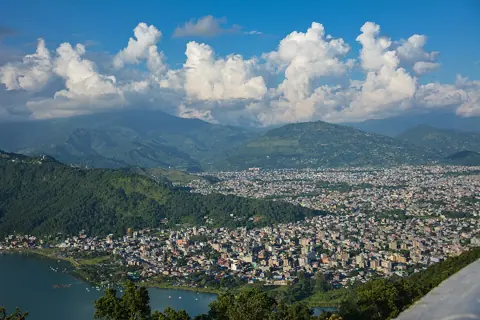
Planning a trek from Pokhara in late September or early October means betting on a date that moves. DHM's normal withdrawal date of 2 October is a long-term normal, and in every year from 2015 to 2021, and again in 2025, the monsoon outstayed it. The other thing that changes the plan is geography: Pokhara lies at about 800 m, within 28 km of peaks above 6,000 m, and monsoon rainfall at two weather stations on either side of the range can differ almost thirtyfold.
When does the monsoon start and end in Pokhara?
DHM, the national weather agency, gives a normal onset of 13 June and a normal withdrawal of 2 October, a season of 112 days. It counts June to September as the monsoon season for its statistics. Its onset and withdrawal record shows how far real years stray from those dates.
| Year | Onset | Withdrawal |
|---|---|---|
| 2015 | 13 June | 3 October |
| 2016 | 15 June | 12 October |
| 2017 | 12 June | 16 October |
| 2018 | 8 June | 5 October |
| 2019 | 20 June | 12 October |
| 2020 | 12 June | 16 October |
| 2021 | 11 June | 11 October |
| 2025 | 29 May | 10 October |
The 2025 row comes from DHM's monsoon 2025 summary, issued on 11 November 2025, which recorded onset 15 days early and withdrawal eight days late, for a 135-day season. These are DHM's country-level dates, which it measures by the monsoon's entry into and exit from eastern Nepal, not at a Pokhara station, and DHM does not publish a separate Pokhara withdrawal date.
For 2026, The Kathmandu Post reported on 20 September that the monsoon had arrived on 19 June, six days late, that withdrawal was expected around 2 October, and that forecasters expected heavy rain in western and central Nepal from 24 to 28 September, advising people to suspend Himalayan treks over that weekend. That is the practical meaning of "late September": the trekking season can open while a monsoon system is still active.
Why the rain changes so much over a short distance
The Annapurna range splits the region into a wet southern side and a rain-shadow northern side. The Nepal Tourism Board describes the region as containing the wettest, driest and windiest places in Nepal, and DHM's 2025 figures show it plainly.
- Lumle, a DHM station at 1,738 m in the hills north-west of Pokhara, recorded 4,588.6 mm between June and September 2025, the highest seasonal total in the country.
- Jomsom, at 2,741 m on the north side of the range in Mustang, recorded 156.1 mm over the same months, the lowest of any station.
That is roughly 29 times more rain at Lumle. DHM also noted that most stations in Nepal's hilly belt recorded more than 66 rainy days (days with at least 1 mm) in the 2025 season, which covers 122 days. For a trekker, the south-facing approaches out of Pokhara sit in the wet zone, while the valleys behind the range sit in its rain shadow.
Is it worth trekking from Pokhara in the monsoon?
It depends on what you want from the trek and how much slack your schedule has. Government travel advice is consistent on the risk: the UK Foreign Office's Nepal safety page, updated 15 September 2026, says monsoon travel, "normally June to October", can be hazardous because flooding and landslides can make roads impassable. The U.S. State Department's Nepal page says landslides frequently damage trails and roads and names the mountain airports at Lukla and Jomsom as especially dangerous because of weather and terrain.
| Window | What the official sources say | Suits |
|---|---|---|
| March-May | One of NTB's two main trekking seasons for Annapurna | Trekkers who want settled conditions before the monsoon |
| June to early October | DHM monsoon season; FCDO and US warn of landslides and road closures | Upper Mustang (NTB), or flexible travellers staying low around Pokhara |
| Mid-October to November | Inside NTB's September-November season, after the monsoon has usually withdrawn | Most first-time Annapurna trekkers |
| December-February | NTB describes Pokhara's winters as mild; FCDO warns of hazards all year, especially above 3,000 m, including avalanches, snow drifts and sudden weather changes | Lower routes; high passes need current local information |
The NTB Pokhara page says peaks above 6,000 m can be seen unobstructed from the city within 28 km, and describes summers as warm and humid. It does not publish visibility statistics by month, and we could not find an official source that does, so treat any claim about the "clearest month" as anecdotal.
Building a plan that survives the date
If you are booking a trek for September or the first half of October, add two or three buffer days after the trek, and schedule the most exposed section (a high pass or a road transfer on a landslide-prone stretch) as late in the trip as your permit and route allow. Rules for guides and permits apply in any season: the FCDO says all foreign independent trekkers must use a local guide or porter in Nepal's national parks and protected areas; our Annapurna permits guide covers the permits themselves.
On the day, the switch condition is a DHM heavy-rain warning for Gandaki Province or reports of blocked roads on your approach. If either appears, move to a low-altitude day around Pokhara and restart the trek when the warning lifts, or re-route towards the rain-shadow side. The FCDO also advises making sure your insurance covers mountain rescue and helicopter costs, which matters most in the shoulder weeks when weather and trails are least predictable.