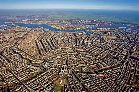
The two-part system: keep water out, then pump water out
The basic logic is simpler than the engineering behind it. According to Holland.com, the official Dutch tourism board's account, roughly one-third of Dutch territory lies below sea level, a situation the country has managed historically by living on raised ground, building dikes, dams and storm surge barriers to keep the sea and rivers out, and then using windmills, pumping stations and steam engines to actively drain and reclaim the land enclosed behind those barriers.
That second step is what turns a dike-protected area into a polder: a stretch of land whose water level is actively managed and kept lower than the water surrounding it, rather than land that is simply above the waterline by nature. Left alone, a polder would slowly refill with rainwater and groundwater seepage. It stays dry only because pumping continues, historically by windmill and now mostly by electric or diesel pumping stations run by regional water authorities.
Flevoland, the country's youngest province, is Holland.com's example of this process taken to its logical end: an entirely new stretch of land created by draining what used to be open water, rather than merely protecting land that was always there.
What the windmills at Zaanse Schans are actually for
Zaanse Schans, a short train ride from Amsterdam, groups a working set of historic windmills that make this system visible up close, though not every mill there does the same job. According to the Zaanse Schans's own site, the mills on site historically ground spices, cocoa, oil and paint, and sawed timber for shipbuilding and construction — industrial uses rather than water management. Among them, the small mill De Hadel is specifically described as having been used to pump water out of a polder, which makes it the clearest single example on site of the drainage function this article is about, alongside the larger industrial mills that represent the Zaan region's other historic water-powered industries.
Access varies by mill: some interiors are open to visitors and others are not, and opening hours and admission differ between the high season (April–September) and the quieter winter months, so check the site's own visiting information for the specific mills you want to enter rather than assuming every mill on the grounds works the same way.
Seeing the reference point inside Amsterdam itself
Before you leave the city at all, Amsterdam has its own small monument to this system. Normaal Amsterdams Peil (NAP), the Amsterdam Ordnance Datum, is the historical reference level against which Dutch elevation and sea-level measurements have long been calibrated. According to the NAP visitor centre, run by the Stichting Normaal Amsterdams Peil foundation, there is a small exhibition space at the Stopera (Amsterdam's city hall and opera building) explaining the history of the datum and displaying markers tied to major flood events, including a reference to the 1953 North Sea flood disaster.
The foundation's own site indicated this centre was closed at the time this guide was researched, which is worth taking seriously rather than assuming it is open on the day you visit — confirm current status before building a stop around it specifically.
Further out: Kinderdijk and the Afsluitdijk
Two larger, more famous examples of Dutch water engineering sit beyond easy walking distance of Amsterdam and are better treated as separate day trips than an add-on to a city visit. Kinderdijk, a UNESCO World Heritage Site south of Rotterdam, groups a larger cluster of historic windmills built specifically for water management, a scale and purpose that differs from the mixed industrial and drainage mills at Zaanse Schans.
The Afsluitdijk, managed by Rijkswaterstaat, the Dutch government's infrastructure and water management agency, is a different kind of site entirely: a 32-kilometre dike built between 1920 and 1932 that separates the Wadden Sea from the IJsselmeer, carrying both a public road and recreational access along its length. Rijkswaterstaat describes it as protecting the country from storms it engineers the structure to withstand at roughly a once-in-10,000-year frequency, and notes it is currently undergoing reinforcement work, including new cladding designed to handle more extreme wave conditions — a sign that this system is maintained and upgraded on an ongoing basis rather than a finished, static structure.
| Site | Distance from Amsterdam | What it shows |
|---|---|---|
| NAP visitor centre, Stopera | Inside the city | The sea-level reference system itself, plus flood history |
| Zaanse Schans | Short train ride | Working windmills, one polder-drainage mill among mostly industrial mills |
| Kinderdijk | Day-trip distance, past Rotterdam | A larger cluster of windmills built specifically for polder drainage |
| Afsluitdijk | Day-trip distance, north | A large sea-defence dike you can drive or walk along |
Before you plan around any single site
Confirm current opening hours and access directly with each site before building a day around it — this guide draws on each venue's own published information at the time of research, but hours, ticket prices and even a site's open/closed status (as with the NAP centre) can change. This guide does not cover flood insurance, engineering detail on pump capacity, or the Delta Works barriers in the southwest of the country, which are a separate system from the sites described here.