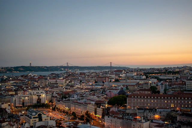
Most visitors notice that central Lisbon's Baixa district feels unusually orderly for a European old town — straight streets, uniform building heights, blocks that actually line up — without knowing why. The answer is a specific historical event with a specific date, and the district's layout is effectively a policy document you can walk through.
What happened on 1 November 1755
On All Saints' Day 1755, an earthquake now generally placed in the magnitude 8.5–9 range struck off the Portuguese coast, followed by fires that burned through the wreckage for days and a tsunami that hit the riverfront. UNESCO's tentative-list entry for Pombaline Lisbon describes the destruction of the city's medieval center as making the event "the very first 'modern disaster'" — an early instance of a catastrophe understood and documented in something close to modern scientific and administrative terms, rather than purely as a religious event, even in an era before that framing was routine.
The area hit hardest was the low-lying commercial center between the Tagus riverfront and the hill leading up to Rossio — the district now known as the Baixa. Older hillside neighborhoods on firmer or different ground, notably Alfama, survived in far better shape and kept their pre-earthquake medieval street pattern, which is why Alfama's narrow, winding lanes and Baixa's straight grid feel like two different cities sitting next to each other.
A rebuild designed as a system, not a repair
The reconstruction was directed by Sebastião José de Carvalho e Melo, the Marquis of Pombal, King José I's chief minister, and it wasn't a patch-up of what existed before. UNESCO's listing describes the plan, drawn up by military engineer Manuel da Maia and carried out by architects Eugénio dos Santos and Carlos Mardel, as amounting to "the first modern Western city" built to a single, comprehensive urban plan at that scale — an orthogonal grid of streets with standardized block and building dimensions, designed before construction began rather than growing organically over centuries.
That standardization went beyond the street layout. The plan incorporated prefabricated building elements and, notably for the period, integrated drainage systems for wastewater and rainwater as part of the original design rather than as an afterthought bolted onto an existing street pattern.
The building code hiding inside the walls
The part of the rebuild most relevant to why this still matters today is structural, and it's invisible unless you know to look for it. Buildings in the reformed Baixa were built using what's now called the gaiola pombalina — literally, the "Pombaline cage" — an internal timber frame built inside the masonry walls, combining flexible cross-braced wood with the surrounding stone and brick.
UNESCO's tentative listing describes comparative studies that identify this system as "the most advanced anti-earthquake system of the 18th century," designed so that interconnected wooden framing in the walls and floors could flex and redistribute seismic force symmetrically through a building rather than letting a single wall fail and bring down everything above it. In effect, Pombal's reconstruction produced something close to an early, city-wide seismic building code, applied consistently across new construction in a way that had no real precedent in European urban planning at that scale.
What to actually look at when you're there
Walk the Baixa's parallel streets — the district still follows the reconstruction's numbering logic, with streets historically named for the trades once concentrated on them (Rua dos Sapateiros for shoemakers, Rua da Prata for silversmiths, among others) — and compare the uniform building heights and window spacing to the older, irregular tile-covered streets climbing up toward Alfama or the Castelo de São Jorge. That contrast is the clearest way to see the before-and-after of the disaster without needing to identify any single structural feature.
Praça do Comércio, the grand riverfront square at the base of the grid, was itself part of the same rebuilding plan and replaced the royal palace that had stood there before 1755 — a deliberate civic statement that the new Lisbon would face the river with a public square rather than a private palace.
What this guide does not cover
This article covers the historical planning and structural response to the 1755 disaster, not modern seismic risk assessments for Lisbon today or current building codes, which are separate, actively updated technical questions best directed to Portuguese civil engineering and geological authorities rather than a travel guide.