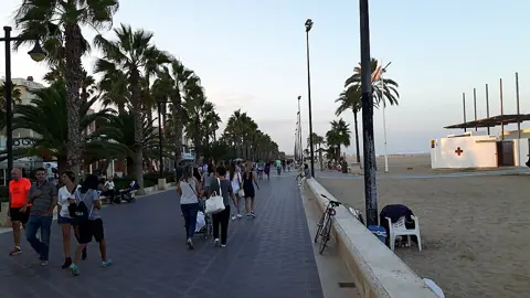
Valencia's river is not in Valencia. The Turia was moved: the Plan Sur cut a new artificial channel 12,692 m long and 200 m wide around the south of the city and left the old bed through the centre dry, and that bed is the Jardín del Turia (Jardí del Túria). Entry is free, and the whole corridor sits below street level, so you can walk or cycle the length of central Valencia without meeting a road junction. Two things it is not: it is not a river walk, because there is no river in it, and it does not reach the sea.
What the 1957 flood forced
The flood that reshaped Valencia arrived in October 1957, and the state's answer was written into law four years later. The preamble to the founding statute records that the great floods of October 1957 caused heavy material damage to the city and its comarca, and that the government's second task, after compensating victims, was to make sure the thing could not happen again (Ley 81/1961, de 23 de diciembre, sobre el Plan Sur de Valencia, checked 15 September 2026). The city's own park literature dates the event precisely to 14 October 1957 (Ajuntament de València, El Jardín del Turia, checked 15 September 2026).
An inter-ministerial technical commission was appointed and came back with three options, named after their geography: north, centre and south. The law's preamble says the northern option was eliminated immediately, the other two were worked through in detail, and the commission reached unanimous agreement that the southern solution was by far the most advantageous. That decision went to the Council of Ministers on 22 July 1958.
The money tells you how large this was. Ley 81/1961 split the hydraulic works 75 per cent to the state, 20 per cent to Valencia city council and 5 per cent to the provincial council, and let the city levy extraordinary local surcharges for ten years to cover its share. Ten years was not enough: a second law extended the levy, stating that municipal and provincial contributions had risen well above forecast because of new requirements and heavy expropriation payments (Ley 24/1971, de 19 de junio, sobre Plan Sur de Valencia, checked 15 September 2026).
How the Plan Sur moved the river
The Plan Sur was never only a river diversion, and that is why so much of central Valencia's layout dates from it. Article two of the 1961 law lists four blocks of work: hydraulic works, roads, railways and urbanisation. The hydraulic block covers the new channel, the preservation of the irrigation system the diversion cut through, new sewer collectors to stop wastewater discharging into the old bed, and bridges to carry roads and railway approaches over the new channel. The roads block adds peripheral roads and a fast east-west route linking the port to the airport; the railway block adds a new central passenger and goods station.
Because the plan rewrote the city's geography, the master plan had to be rewritten to match. That happened in 1966, when the government approved the revision of the general urban development plan for Valencia and its comarca and its adaptation "to the southern solution for the diversion of the river Turia" (Decreto 1988/1966, checked 15 September 2026).
For a visitor the practical consequence is simple. Any water you see inside the park was put there deliberately by landscape architects decades after the river left, and the river you might expect to find is several kilometres to the south, running in a concrete-flanked channel most people never see. If you have come to Valencia to walk along the Turia, you will be walking along where it used to be.
The motorway that was never built
Valencia's empty riverbed was first drawn as a road, not a park. The Ajuntament's own account of the park's history is unusually blunt about it: the dry corridor was initially planned as "un río de gasolina", a river of petrol, and it was economic difficulty in finishing the artificial channel, rather than any change of heart, that slowed construction of the intended motorway.
What changed the outcome was a campaign. Through the 1970s a citizens' mobilisation ran under the slogan "El riu és nostre i el volem verd" - the river is ours and we want it green - and, after lengthy wrangling over who owned the land, it ended in the approval of the Plan Especial del Río Turia, the legal and technical decision to convert the old bed into an urban park (Ajuntament de València, El Jardín del Turia, checked 15 September 2026).
The 1988 revision of the general plan then absorbed the park decision wholesale, extended the garden westwards with the new Parque de Cabecera, and gave the corridor metropolitan status rather than leaving it a municipal amenity. The garden is therefore run as one continuous piece of green infrastructure, not as a string of neighbourhood gardens.
What fills the riverbed now
The Turia Garden is divided into eighteen numbered stretches, or tramos, each designed as a separate project, which is why it changes character every few hundred metres rather than reading as one landscape. The table below matches the stretches most visitors actually walk to what is in them.
| Stretch | Where it runs | What is in it |
|---|---|---|
| Parque de Cabecera | Western end, the old river "head" | Lake, viewpoint hill, riverside woodland, Bioparc |
| Tramos 1-2 | Nou d'Octubre bridge to the Casa del Agua | Playgrounds, open lawns, pine and jacaranda planting |
| Tramos 10-11 | Beside the Palau de la Música | Formal geometry, large pond, citrus, cypress, palms |
| Tramo 12 | Between the Ángel Custodio and Reino bridges | Gulliver, giant chess boards, mini-golf, skate area |
| Tramos 13-16 | Alameda prolongation to the railway crossing | City of Arts and Sciences, Umbracle, rose garden |
Parque de Cabecera covers nearly 170,000 square metres at the western end and is where the design most obviously imitates a river, with a central lake, small islands and waterfalls fed from the Molí del Sol; Bioparc sits inside it, reached across a footbridge laid over the old bed (Visit València, Parque De Cabecera / Bioparc, checked 15 September 2026). At the other end, the eastern stretches carry the Palau de les Arts, the Hemisfèric, the Museu de les Ciències, the Àgora and the Oceanogràfic, with the Umbracle's eighteen-metre arches closing the southern edge (Ajuntament de València, Jardín del Turia tramos 10-18, checked 15 September 2026).
The last two stretches were designed and not built. The city's guide describes tramos 17 and 18 as pending development, to become a "Gran Delta Verde" where the garden would finally meet the Mediterranean, and the current tourist-board description still ends the park at the City of Arts and Sciences (Visit València, Turia Garden, checked 15 September 2026). Do not plan a walk from the park to the beach expecting the green to continue.
Using the park as a route
The Turia Garden is most useful as transport, because it gives you a continuous traffic-free line across central Valencia. Visit València puts the garden at over nine kilometres, gives an end-to-end crossing of roughly 30 minutes by bike against most of a day on foot, and describes a marked running route of more than five kilometres, with bike hire around the garden from EUR 10 (Visit València, Turia Gardens in Valencia, checked 15 September 2026). Treat the hire price as indicative and confirm it with the operator.
Navigation inside the park is done by bridge, not by street name. Eighteen bridges from different periods cross it, from the Gothic Trinity Bridge to Santiago Calatrava's Assut de l'Or, and several of them are also your way in and out: the Puente del Mar is identified by the staircases that drop into the garden and the Serranos bridge by its carriage ramps (Visit València, Bridges of the Turia Garden, checked 15 September 2026). Learn three bridge names near your accommodation and you will never be lost in the bed.
Opening hours inside the park are not uniform, and the one that catches families out is Gulliver. Visit València lists it as free all year but shut in the middle of the day in high summer, with July and August hours of 10:00-13:30 and 17:30-21:00, shorter winter hours, and closure on 25 December and 1 January (Visit València, Gulliver Park, checked 15 September 2026). Parque de Cabecera, by contrast, is listed as open 24 hours.
What this guide does not cover
The Turia Garden is not a flood defence, and nothing here says Valencia is safe from flooding. The protection is the new channel, specified in 1961 for 5,000 cubic metres per second, and the wider metropolitan drainage network is still being rebuilt around it: in August 2025 the environment ministry issued an impact ruling for a Confederación Hidrográfica del Júcar project to recondition the barranco de la Saleta over roughly 7.8 km from Aldaia to the new Turia channel, described as part of a broader set of works to reduce flood hazard in the barranco del Poyo basin (BOE, Resolución de 26 de agosto de 2025, checked 15 September 2026).
Three gaps you should know about. We could not establish from any official page the exact date the new channel entered service, so this guide gives the legal milestones instead: the 1961 law, the annual state payments it scheduled from 1962 to 1971, and the 1976 royal decree that already calls the old course the "antiguo cauce". Generalitat Valenciana websites, including the pages for the Parc Natural del Túria upstream, could not be retrieved at the time of writing, so nothing here describes that natural park. And no ticket prices or opening times for the City of Arts and Sciences venues are given, because those change; take them from each venue's own page.
If you want one decision out of all this, make it a direction. Start at the western end, at Parque de Cabecera, where the design deliberately recreates the vanished river, and travel east; by the time you reach the Ciutat de les Arts i les Ciències you will have crossed the whole city underneath its traffic, which is what the campaigners were arguing for.