Eighteen islands make up the Faroe Islands, seventeen of them inhabited, spread across the North Atlantic between Iceland and Norway. What makes the geography workable for a visitor is not the islands themselves but the infrastructure the Faroese have built to stitch them together — a project that has moved, within a couple of generations, from small ferries and mountain passes to a network of subsea tunnels that includes one with a roundabout under the ocean floor.
Why the islands needed connecting at all
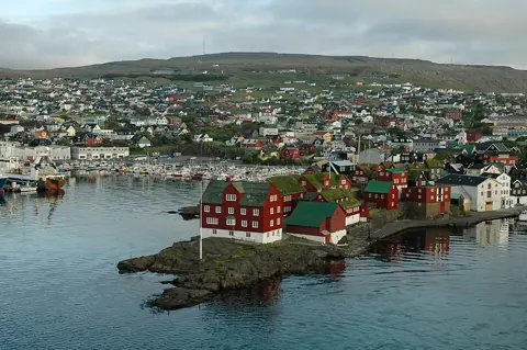
The Faroe Islands are mountainous and steep-sided, with settlements historically separated by fjords, sounds, and open water rather than by roads. For most of the twentieth century, getting from one island to another, or even between two towns on the same island, meant a boat, a mountain road closed by snow for parts of the winter, or both. Population and jobs concentrated where the sea made travel easiest, which is part of why Tórshavn, on Streymoy, grew into the capital and largest settlement.
That pattern started changing with bridges and causeways linking Streymoy to Eysturoy, and accelerated sharply with a tunnel-building programme that has, since the 1960s, added road tunnels through mountains and, more recently, subsea tunnels running under the fjords themselves.
The subsea tunnels, one by one
Four road tunnels currently run under the sea between islands, operated on a shared payment system:
- Vágatunnilin connects Streymoy to Vágar, the island with the international airport, removing what used to be a ferry-dependent link between the airport and the capital region.
- Norðoyatunnilin connects Eysturoy to the Northern Isles around Klaksvík, the country's second-largest town.
- Eysturoyartunnilin, opened in 2020, connects Streymoy to Eysturoy and is the one with the roundabout: inside the tunnel, the route splits into two branches — one running roughly 2.15 kilometres to Runavík and another roughly 1.6 kilometres to Strendur — meeting at a junction under the strait that carries decorative lighting and public art, built as a functioning intersection rather than a stop.
- Sandoyartunnilin, opened in late 2023, connects Streymoy to Sandoy, an island that previously depended entirely on a car ferry.
Where tunnels stop and ferries take over
Tunnels connect the most populous cluster of islands — Streymoy, Eysturoy, Vágar, and Sandoy — plus the Northern Isles corridor through Klaksvík. Beyond that cluster, the state ferry and bus operator Strandfaraskip Landsins (SSL) runs the routes that keep everything else reachable: a ferry to Suðuroy in the south, a passenger ferry to the cliff-bound island of Mykines, routes to Kalsoy, Hestur, Nólsoy, and the more remote Svínoy and Fugloy. Some of these ferries carry cars, some are passenger-only, and several run only a handful of times a day, which matters if you're building a day trip around one.
A small number of the most remote settlements are reached by scheduled helicopter rather than ferry when sea or weather conditions make boat travel unreliable, a service used by residents as much as visitors.
Why weather still governs the plan, tunnels or not
Tunnels solved the problem of mountain passes closing in snow and ferries being cancelled for short inter-island hops, but they did not remove weather from the equation entirely. Ferries to the more exposed islands — particularly Mykines, where the crossing runs through open water past sea cliffs, and Suðuroy, the longest ferry route — are still cancelled or delayed in strong wind and heavy swell. Flights to Vágar, the only airport, are affected by fog and crosswind, both of which occur often enough in the Faroese climate that a one-day layover built around a single flight leaves little room for error.
Reading a map of the islands correctly
A Faroese road map can be misleading if you read distances the way you would on a flat mainland. Roads wind around fjords and climb over passes even where tunnels exist, and a distance that looks short in kilometres can take considerably longer than the same distance would on a straight motorway. Driving times posted by rental companies and the tourist board tend to already account for this, so use those figures rather than estimating from raw map distance.
The tunnel network has also changed which towns function as day-trip bases. Klaksvík's working fishing harbour, once a genuine journey from Tórshavn, is now a realistic half-day round trip because of the Norðoyatunnilin, while Sandoy — long treated as a separate, ferry-only excursion — is now within easy reach of central Streymoy.
Before you build a route
Check which of your planned stops depend on a tunnel versus a ferry or flight, and treat the ferry- and flight-dependent legs as the parts of your itinerary that need a backup day. For current ferry and bus schedules, use Strandfaraskip Landsins' own booking and timetable system rather than a fixed printed schedule, since sailings are adjusted for weather and maintenance through the year.