Rome opened a metro line in 1955 and then waited twenty-five years for the second one. ATAC's own company timeline puts it flatly: the first train of the "Metropolitana di Roma" ran in 1955 from Termini to the EUR district, and "dopo 25 anni" Line A followed in 1980 between Ottaviano and Cinecitta (ATAC, Storia, checked 15 September 2026). Seventy years after that first train, the network is still three lines and about 59 km (ATAC, Azienda, checked 15 September 2026). The practical consequence for you is simple and it is not usually spelled out: several of the sights you have come for have no metro station, and you will walk to them.
What Rome actually has
Rome runs three metro lines, one of which has a branch, and that is the whole system. Roma Servizi per la Mobilita's PUMS technical paper on metro development, dated August 2019, gives the per-line figures as 18.174 km and 27 stations for Line A, 18.015 km and 22 stations for Line B, 4.294 km and 4 stations for the B1 branch, and 18.927 km and 22 stations for Line C at that date (Roma Servizi per la Mobilita, Azioni di sviluppo della rete metropolitana, checked 15 September 2026). Line C has grown since.
The table below sets out the four line designations you will see on a Rome metro map, when each entered service and roughly where it runs.
| Line | Entered service | Runs between |
|---|---|---|
| B | 1955, extended 1990 | Laurentina and Rebibbia, via Termini |
| A | 1980, extended 1999-2000 | Anagnina and Battistini |
| B1 | 2012 | Laurentina and Jonio, branching at Bologna |
| C | 2014 onward | Monte Compatri-Pantano and Colosseo / Fori Imperiali |
Dates are from ATAC's history timeline and the termini from the operator's published line hours (ATAC, Storia and Roma Servizi per la Mobilita, Linee e orari di metro e ferrovie, both checked 15 September 2026). Note what the table does not contain: a line that crosses the centro storico from north to south, or anything resembling the dense inner grid of a comparable capital.
Why digging here is different
Every metro excavation in central Rome is legally an archaeological excavation first and a construction site second. Metro C Scpa states that works along the whole route from Monte Compatri-Pantano to Colosseo / Fori Imperiali were carried out in "modalita archeologica", with archaeological remains monitored as the work proceeded, and puts the volume dug that way at 585,000 cubic metres, which the company describes as more than double the largest previous archaeological excavation in Europe (Metro C Scpa, L'opera, checked 15 September 2026).
That is not a delay imposed on the project from outside. It is the project. Archaeological supervision can also forbid the techniques that make tunnelling fast: between San Giovanni and Porta Metronia, where the archaeological layer sits roughly 18 to 20 metres below street level, the Soprintendenza Speciale ruled out ground consolidation carried out from the surface, and mechanised tunnel-boring had to be replaced by open excavation (Metro C Scpa, Line under construction, checked 15 September 2026).
Cost and archaeological risk are now written into Rome's own planning documents as reasons to route new capacity elsewhere. The PUMS metro paper says the aim is to provide access "anche alle aree a minor costo e con minori rischi per lo strato archeologico" -- also to areas at lower cost and with less risk to the archaeological stratum -- and sets out tram extensions and existing rail as the instruments for parts of the city where a metro is not justified (Roma Servizi per la Mobilita, August 2019, checked 15 September 2026).
What Line C found
Line C's excavations produced finds that changed the schedule and then changed the stations. Below Porta Metronia, diggers hit a Roman barracks of the 2nd century AD with more than thirty rooms, wall frescoes and mosaic floors, a building razed and partly buried when the Aurelian Walls went up; the archaeological excavation there reached about 15 metres below street level and moved almost 50,000 cubic metres of stratigraphy across 3,300 square metres (Metro C Scpa, Porta Metronia Station, checked 15 September 2026).
At San Giovanni the story was water rather than soldiers. Excavation at around 20 metres uncovered a large agricultural estate of the early imperial period and a hydraulic basin of roughly 35 by 70 metres able to hold more than four million litres, which Metro C Scpa describes as without parallel in the Roman countryside (Metro C Scpa, Museo sotto i piedi, checked 15 September 2026).
Under the Colosseum end, the finds were domestic and ritual: a circular monumental structure 14 metres across, probably a fountain, of the Flavian period, plus 25 wells, of which 16 were lined with tufa slabs that were dismantled and kept (Metro C Scpa, Fori Imperiali Station, checked 15 September 2026).
Stations that became museums
Three Line C stations now display what was dug out of them, which is Rome's answer to a problem it could not avoid. The table compares what each station yielded and how the material is presented.
| Station | Principal find | How it is shown |
|---|---|---|
| San Giovanni | Imperial water basin, farm estate, peach remains | Displays arranged by depth across five underground levels |
| Porta Metronia | Hadrianic barracks, over thirty rooms | Museum level of about 4,000 sq m with relocated structures |
| Colosseo / Fori Imperiali | Flavian circular structure, 25 wells | Five museum areas, sectioned wells and floor fragments |
Porta Metronia and Colosseo / Fori Imperiali both opened to the public on 16 December 2025, and Colosseo / Fori Imperiali is the first interchange between Line B and Line C, reached by an underground bridge built over the existing Line B tracks (Roma Servizi per la Mobilita, Metro C, inaugurate le fermate Colosseo e Porta Metronia and Metro C Scpa, Fori Imperiali Station, both checked 15 September 2026). San Giovanni, open since May 2018, is the interchange with Line A.
Where the line goes next
Line C is planned as 29 km and 31 stations, of which 24 stations are in service, so the unfinished part is most of the way across the historic centre (Metro C Scpa, L'opera, checked 15 September 2026). The next station is Venezia, under Piazza Venezia: a box about 40 metres deep on eight underground levels, with perimeter diaphragm walls driven to about 85 metres, sitting on top of the Via Flaminia of 223 or 220 BC and the vaulted halls of Hadrian's Auditoria (Metro C Scpa, Venezia Station, checked 15 September 2026).
Beyond Venezia the record is one of long pauses. Metro C Scpa states that design of the roughly 4 km T2 section towards Clodio/Mazzini, with Chiesa Nuova, San Pietro, Ottaviano and Clodio/Mazzini, was suspended in March 2010 and only restarted after funding in the 2023 budget law, while the 3.3 km Farnesina-Clodio/Mazzini stretch with two more stations remains at preliminary design (Metro C Scpa, The future of the line, checked 15 September 2026).
What has no metro
Rome's most-photographed monuments are, with one exception, not on the metro at all. On ATAC's published line A diagram there is no station named for the Pantheon, Piazza Navona or Campo de' Fiori, and on the three lines as a whole there is no station at the Pantheon, none at Piazza Navona, none at Campo de' Fiori, none at the Trevi Fountain and none at Piazza Venezia until the Venezia station is finished. The Colosseum is the exception, and it now has two lines rather than one.
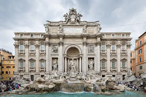
The Trevi case is the one that catches people out, because a station carries the name. Line A's station at Piazza Barberini is signed Barberini - Fontana di Trevi on ATAC's line diagram (ATAC, line A diagram, checked 15 September 2026), but you surface in a different square and walk down through side streets to reach the fountain. The name tells you the direction, not the distance.
Planning your days around it
Group the sights that have no station into a single walking day rather than returning to the centre repeatedly. The Pantheon, Piazza Navona, Campo de' Fiori and the Trevi Fountain sit close to one another in the bend of the Tiber; entering that area once, on foot, and leaving it once is far more efficient than three separate metro journeys that each end several hundred metres short.
Use the metro for the long hops at the start and end of the day, and check the hours before you rely on it late. Roma Servizi per la Mobilita lists last departures at about 23:30 on Lines A, B, B1 and C from Sunday to Thursday, extended to about 01:30 on Friday and Saturday (Linee e orari di metro e ferrovie, checked 15 September 2026). Confirm the current times on that page before a late evening, because single-line closures for works are common.
Two things this guide does not do. It does not cover fares, ticket types or validation, which are a separate question with their own rules. And it does not tell you which buses or trams reach the car-free parts of the centre, because those routes change with roadworks and processions and only the operator's live service pages are worth trusting on the day.