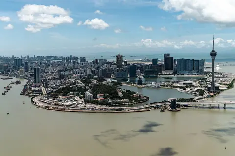
The tourist triangle — the historic centre, the Cotai resorts, the ferry terminals — takes up a small fraction of 33.4 square kilometres. Everything else is somebody's neighbourhood.
How concentrated is Macau's population?
Extremely, and unevenly. The Statistics and Census Service publishes density by district, and the spread between them is the single most useful fact for understanding the city's texture.
| Area | Population density, 2025 |
|---|---|
| Macao SAR total | 20,500 per km² |
| Macao Peninsula | 56,400 per km² |
| Taipa | 14,600 per km² |
| Coloane | 5,300 per km² |
At parish level, the 2021 Census put Nossa Senhora de Fátima — the northern peninsula — at 256,381 people, against 55,275 in Sé, the parish that contains much of what visitors see.
Which districts do residents actually live in?
Not the ones in the guidebooks. DSEC's 2025 figures name Baixa da Taipa as the most populous statistical district at 75,000 people, or 10.9 per cent of the total, followed by Novos Aterros da Areia Preta at 10.5 per cent and Areia Preta and Iao Hon at 9.7 per cent.
None of those three appears on a standard visitor itinerary. All three are ordinary high-rise residential districts, and the fastest-growing in 2025 was Móng Há and Reservatório, up 2,200 people.
The housing mix explains what you see there. In the 2021 Census, 80.4 per cent of Macau's 201,817 land-based households were in private housing, 13.2 per cent in subsidised economic housing and 6.4 per cent in social rental housing — with the public housing heavily concentrated in specific districts such as Ilha Verde, where 5,764 of 8,261 households were in economic or social housing.
Where does the World Heritage boundary actually stop?
Well short of the northern districts. The Cultural Affairs Bureau's own list of the Historic Centre of Macao comprises 22 buildings and 8 squares — 30 entries — inscribed in 2005, covering an area of 16.17 hectares with a 106.79-hectare buffer zone.
Read that area figure against the 33.4 square kilometres of the territory. The inscription is small, and it is all in the south and centre of the peninsula.
The northern districts do hold classified heritage, just not World Heritage. Mong-Há Fortress, Lin Fong Temple, Kun Iam Tong, the Border Gate, the Patane night watch house and the Red Market are all officially classified immovable properties in their own right, outside the inscription.
What is the Red Market and why does it matter?
It is a working municipal market that happens to be a classified building, which makes it the cleanest single stop for seeing residential Macau. The Cultural Affairs Bureau lists it as reference AM010, in the category of buildings of architectural interest, and the Municipal Affairs Bureau records that it was acclaimed as a building with architectural interest in 1992.
| Detail | Value |
|---|---|
| Official name | Almirante Lacerda Market |
| Opened | 1936 |
| Hours | 7:00 a.m. to 7:30 p.m. |
| Sells | Seafood, meat, vegetables and groceries |
| Address | Rua Leste do Mercado Almirante Lacerda |
The Municipal Affairs Bureau's own account of it is worth knowing before you go: the market was built for what was then a high-end villa district, designed to match it, in raw red brick without plaster — which is where the popular name comes from.
How do you get there, and what changes when you arrive?
By bus, mostly. The Transport Bureau's route enquiry lists 92 bus routes, and buses are the mode that reaches residential Macau. The light rail serves the island side; the casino shuttles serve the resorts.
What changes on arrival is the premise rather than the scenery. In the visitor districts, the assumption is that you do not live here. Two streets north, the assumption reverses.
- Menus and shop signage are frequently Chinese only, with no English version to ask for
- Shops keep residential hours, which means earlier closing than the resort strip
- Prices are set for residents rather than for visitors
- Walking is uphill in places: Guia Hill rises to 91 metres and is the peninsula's highest point, with a 1,200-metre fitness trail around it and a 1,000-metre one on Mong Há Hill
What this guide does not cover
Two figures were deliberately left out. DSEC publishes land area only for the peninsula, Taipa, Coloane and the reclamation zones, not by parish, so no parish-level density figure appears here — Nossa Senhora de Fátima's 256,381 people cannot be turned into a density without an official area for it.
The number and identity of Macau's bus operators is also absent. The Transport Bureau's route list shows 92 routes but names no operator, and the operators' own sites could not be read, so this guide states the route count and nothing more.
Individual shops, stalls and restaurants are outside this guide's scope entirely, because that is field information that cannot be verified from published sources and goes stale fastest.