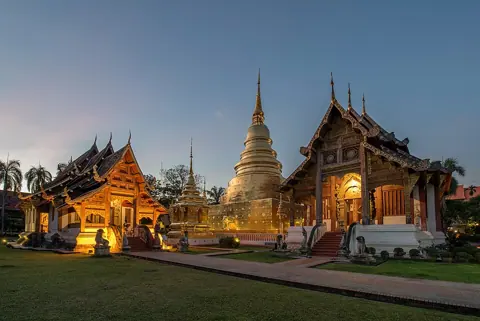
Chiang Mai is on a UNESCO list, but not on the World Heritage List. Thailand placed "Monuments, Sites and Cultural Landscape of Chiang Mai, Capital of Lanna" on its Tentative List in 2015, and UNESCO's Thailand page still shows it there rather than among the inscribed properties.
This guide explains what that UNESCO entry says about the city's founding, its walls, gates and moat, and the wider Lanna sites around it, and what you can see today. It draws on the UNESCO entry, the Tourism Authority of Thailand and the Fine Arts Department, which the entry names as responsible for restoration planning.
A city planned in 1296
UNESCO's entry dates the city precisely. It says "Chiang Mai was purposefully created by King Mangrai in AD.1296 to be the political, economic, social and cultural center of his newly expanded and integrated kingdom of the Tai people, called 'Lanna Kingdom'."
The site was chosen five years earlier. According to the entry, in 1291 Mangrai "came across an ideal location at the foothills of Doi Suthep which sloped down from the west to the great river basin in the east."
The founding story lists seven good omens. They include a white mouse-deer family unafraid of people, Doi Suthep being regarded as sacred, water cascading from the mountain, land that was higher in the west and lower in the east, a stream flowing east into the Mae Ping River, and a large lake to the northeast.
The entry adds detail to two more of the omens. It says a family of red-furred mouse deer chased away soldiers, and that Doi Suthep was regarded as the abode of Sudeva, the legendary creator of Haripunchai.
The entry gives figures for the building effort. It says 50,000 men were recruited to build the royal residence and another 40,000 to build "the city walls, observation towers, city gates, and city moats", and that "After 4 months, the construction works were completed."
The plan carried meaning as well as defence. UNESCO's entry says the fortified city "was rectangular in shape, almost a square", designed "to symbolize a human figure with the head, the back, the stomach, the hands and the feet", and that Mangrai combined Tai beliefs, the knowledge of the indigenous Lawa people and Hindu-Buddhist cosmology.
The body image is taken literally in places. The entry describes the city's "stomach" as "facing the river on the east, full and round and hanging down from the northeast to the south, like that of a pregnant woman", and says this part "was doubly protected by the outer walls and moats."
At the centre is a spot called Sadue Muang, "the city's navel", where the entry says "the soul or the spirit of the city resides". It adds that Mangrai ruled Lanna from Chiang Mai for 20 years and died at that central spot.
Walls, gates and corner bastions
The inner fortification is the core of what visitors see. UNESCO's entry lists it as one group: the inner city walls on four sides, the inner moats on four sides, five gates and four corner bastions, which it calls "jaeng".
The five gates, with the entry's own spellings and positions, are these. Pratu Chang Puak, "formerly Pratu Hua Kuang", is in the north; Pratu Suan Dok in the west; Pratu Tha Pae in the east; "Pratu Tai Wiang, in the southeast, later renamed Pratu Chiang Mai"; and Pratu Saen Pung in the southwest. "Pratu" means gate.
The four corners are named as Jaeng Sri Phum in the northeast, Jaeng Huo Lin in the northwest, and Jaeng Katam and Jaeng Gu Huang. The entry places both of the last two "in the southwest", which leaves the southeast corner unassigned, so their exact positions are not given here.
The walls are not intact. UNESCO's entry says: "The inner city walls on 4 sides, destroyed in certain parts, but restored in important sections and are in good restoration conditions."
Restoration has a date. The entry says the fortification "restored most recently in 1985-86 by the Chiang Mai Municipality and the Fine Arts Department", and that the gates were "restored in different historical periods, and last restored by the City Municipalities and the Fine Arts Department, based on archaeological studies and old photo."
The entry also says the fortification is "protected as archeological property under National Act for the protection of ancient monuments", and that the Fine Arts Department "will be responsible for the restoration plan and design".
The walls you see were also reshaped long after Mangrai. The entry records that Chiang Mai was "taken under the control of Burma in 1558 by the expansive king, Bayinnaung", that "In 1775, a group of Lanna princes based in Lampang rebelled against the Burmese", and that afterwards "the fortification of the city was completely overhauled by King Kawila" of the "Choa Cet Ton Dynasty", "as the threats of war still continued."
| Name | Local name | What it is | Price range |
|---|---|---|---|
| City moat | คูเมืองเชียงใหม่ | Inner moat on all four sides of the old city | No fee stated |
| Tha Phae Gate | Not given in the source | East gate (Pratu Tha Pae) | No fee stated |
| Chang Puak Gate | Not given in the source | North gate, formerly Pratu Hua Kuang | No fee stated |
| Chiang Mai Gate | Not given in the source | Southeast gate, formerly Pratu Tai Wiang | No fee stated |
| Jaeng Sri Phum | Not given in the source | Northeast corner bastion | No fee stated |
| Kampaeng Din | Not given in the source | Outer wall on the east and south sides | No fee stated |
| Wiang Kum Kam | เวียงกุมกาม | Mangrai's earlier capital, now a historical park project | Not published |
| Chiang Mai National Museum | พิพิธภัณฑสถานแห่งชาติ เชียงใหม่ | Fine Arts Department museum | Not published |
The moat and outer wall
The moat appears in UNESCO's entry on all four sides, listed with the walls as part of the fortification group. The Fine Arts Department's Chiang Mai National Museum features the moat, คูเมืองเชียงใหม่, in one of its own public posts, headed with the line that the Chiang Mai moat has geese.
Chiang Mai also had a second, outer line. The entry describes "The Outer Walls which are now called 'Kampaeng Din' located on the eastern and southern sides", with four outer gates and outer moats of their own.
The UNESCO entry lists this outer line as a separate group from the inner fortification, and it does not say when the outer wall was built.
No official measurement of the moat or walls was found. UNESCO's entry gives a dimension for only one enclosure, Chet Lin, and not for the city square.
That enclosure is worth knowing about. The entry says Chet Lin, "meaning 7 streams, is located at the foot of Doi Suthep only 5 km. from the Chiang Mai Old City, and was seen from an aerial photograph dated 1957 as a doubled walled circular area, with a diameter of 900 m."
If you want to walk the moat and walls, the guide to how the city is laid out explains the old city's position relative to the rest of Chiang Mai.
Temples inside the old city
The walls enclose dozens of Lanna temples that UNESCO includes in the proposal. Its entry lists about 40 monuments inside the fortification, grouped by direction from the centre.
A few carry dates in the entry. Wat Chiangman is dated 1296, the founding year; Wat Chedi Luang 1411; and Wat Pra Singh is described as "built by King Phayu, 1345-1355". Wat Intakhin is also listed as Wat Sadue Muang, the name the entry gives the city's navel.
Other dated temples in the list include Wat Duang Dee (1496), Wat Prasat (1492), Wat Pha Pong (1492) and Wat Fon Soy (1488), and the entry also includes a market, Kuang Luang. Most dates in the list fall between the founding and the early 16th century. In the northern group the entry gives Wat Hua Kuang-Saen Muangmas as 1521, Wat Moh Kam Duang as 1476 and Wat Kuan Ka Ma as 1492; in the central group Wat Chai Pra Kiat is 1517 and Wat Pra Choa Mangrai 1296; in the western group Wat See Kerd and Wat Tung Yu are both 1517; and in the southern group Wat Puak Hongs and Wat Puak Taem are 1517.
The eastern group has no dates at all in the entry. It lists Wat Muen Lan, Wat Dok Kam, Wat Dok Uang, Wat Pan Un, Wat Pha Khoa and Wat Sampoa among others.
One date in the list, for Wat Muen Ngern Kong, is given as "1339-1337", an impossible range, so it is not repeated here.
For Chiang Mai's Sunday market, the guide to the Sunday Walking Street explains how it operates.
Doi Suthep and the wider landscape
UNESCO's proposal reaches well beyond the walls. Its first group is a cultural landscape: Doi Suthep-Pui National Park, Wat Pra That Doi Suthep, the road up the mountain, Wat Pa Lad, Chet Lin, the Mae Ping River and the Mae Kha stream.
The Tourism Authority of Thailand describes the mountain temple. It says Wat Phrathat Doi Suthep sits "at an elevation of 1,056 metres", about "an easy half hour drive from downtown Chiang Mai", that it "dates back to the late 14th century", and that "A staircase of over 300 steps or alternatively a funicular cable car" leads up to a "24-metre tall golden chedi".
On the way up is Wat Pha Lat. The tourism authority says it was built in the mid-14th century as "originally a resting place for people making their way to the Doi Suthep temple" and became a meditation site for monks in the 1930s; its name translates as "Monastery at the Sloping Rock".
The same authority describes another hill temple in the proposal. It says Wat Prathat Doi Kham, a half-hour drive from the city, is known as the "Golden temple" for its 17-metre Buddha image decorated in gold, has a 300-step staircase or funicular, and "was built over 1,300 years ago in 687 A.D.", which would make it far older than Chiang Mai itself; UNESCO's entry lists Wat Phra That Doi Kam without a date. The tourism authority adds that the temple was revived after a hidden chamber containing ancient Buddha images was found in 1966.
Outside the inner walls, the entry's fifth group adds Wat Lok Molee, Wat Jed Yod, which it says was built by King Tilokaraj, Wat Suan Dok, Wat Umong, Wat Ram Poeng and others, along with Nawarat Bridge, Warorot Market, Ton Lamyai Market and Chiang Mai Railway Station. Its northern environs also include Wat Chiang Yeun, Wat Pa Ket and Wat Ku Toa, and its southern environs Wat Pa Jee, Wat Pong Noi, Wat Nantharam and Wat Chiang Khong.
The last group is modern. It lists "The First Christian Mission in Chiang Mai, The first school building of the Prince Royal College, The first school building of Dara College, The first hospital building of the McCormic Hospital, The first Chinese community temple, The first Sikh temple, The first Muslim community and mosque".
Getting up the mountain and around these scattered sites takes transport; the guide to red trucks, apps and scooters sets out the options.
Wiang Kum Kam, the lost capital
Chiang Mai was not Mangrai's only capital. UNESCO's entry says Wiang Kum Kam "is, according to the Chiang Mai Chronicle, the former Capital of Mangrai, located in Saraphi District, South of Chiang Mai."
The entry says it was "Inundated by the floods and deserted for many centuries", and that it "has been excavated and restored and is presently being revived as an archaeological and a historical Park." It lists 22 temples at the site, and it separately lists the old road from Lamphun to Wiang Kum Kam as part of the proposal.
The Fine Arts Department has a project office for the site. Its Chiang Mai regional office, Fine Arts Office 7, refers in its notices to the Wiang Kum Kam Historical Park project office (อุทยานประวัติศาสตร์เวียงกุมกาม) in Tha Wang Tan subdistrict, Saraphi district.
For objects rather than ruins, the department's Chiang Mai National Museum is on the Chiang Mai–Lampang Superhighway in Chang Phueak subdistrict. Its site gives exhibition hours of Wednesday to Sunday, 09:00 to 16:00, and telephone numbers of (053) 221 308 and (053) 408 568; it does not list an admission fee. The museum office keeps separate hours, Monday to Friday from 08:30 to 16:30.
| Site | What survives, per official sources | Best for |
|---|---|---|
| Inner walls and gates | Restored sections; gates restored using research and old photos | The city plan and a short walk |
| Moat | Inner moats on all four sides | Walking or cycling the square |
| Kampaeng Din | Outer wall on the east and south sides | The outer defensive line |
| Old-city temples | About 40 listed sites, several dated 1296-1521 | Lanna temple architecture |
| Wiang Kum Kam | Excavated, restored ruins; 22 temples listed | An earlier capital |
| Doi Suthep | Mountain temple at 1,056 m with 24 m chedi | The landscape setting |
What the Tentative List means
UNESCO's Thailand page keeps two separate lists: properties inscribed on the World Heritage List, and the Tentative List. Chiang Mai appears only on the second.
Chiang Mai's entry was submitted on 9 February 2015 by the Thailand National Committee for World Heritage, as a cultural property under criteria (i), (ii), (iii) and (vi). It claims the city "represents a masterpiece of human creative genius in the field of urban planning" and bears "exceptional testimony to a civilization that is still living", the Lanna civilization.
The other two criteria widen the claim. Under criterion (ii) the entry argues for an "important interchange of human values, over different periods covering a span of more than 700 years" in the Lanna region, and under criterion (vi) it says the monuments are "tangibly associated with many ceremonies, celebrations, festivals and other traditions organized by temples and communities on a regular basis."
The entry also sets out how the case would be judged. It says the integrity of the monuments, sites and landscape "rests on three pillars", and it compares Chiang Mai with other properties, among them Luang Prabang in Laos.
Meanwhile, UNESCO's Thailand page lists six inscribed cultural sites: Ayutthaya and Sukhothai, both inscribed in 1991, Ban Chiang in 1992, Si Thep in 2023, Phu Phrabat in 2024 and Wat Phra Mahathat Woramahawihan in Nakhon Si Thammarat in 2026, while Chiang Mai remains on the Tentative List alongside later entries such as Phra That Phanom (2017) and Wat Arun's Phra Prang (2025).
What this guide does not cover
No official measurement of the length of the walls or moat was found, so none is given. Thai-script names for the individual gates and corner bastions are not given because no official source read provides them, and the positions of two corners, Jaeng Katam and Jaeng Gu Huang, are left open because UNESCO's entry places both in the southwest.
Admission fees and opening hours for Wiang Kum Kam and for temples inside the old city are not included, because the official pages read do not publish them; the Chiang Mai National Museum's page gives hours but no fee. The Chiang Mai Municipality's websites could not be opened, so any restoration after 1985-86 is not described.
The UNESCO entry's page could be read only through an automated reader rather than downloaded directly, so quotations are as that page presents them. No official statement on when, or whether, Thailand will submit a full nomination for Chiang Mai was found.