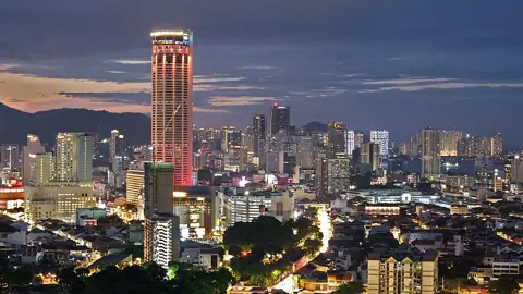
UNESCO does not regulate a single shophouse in George Town. The body that decides whether an owner may repaint a facade, hang a signboard or add a storey is the Penang Island City Council (Majlis Bandaraya Pulau Pinang, MBPP), working from a planning document the Penang state government gazetted on 1 September 2016. The World Heritage listing is the reason that document exists; the document is the thing with legal force, and it is unusually specific about what you are looking at on Lebuh Armenian.
What the listing actually covers
The World Heritage listing George Town belongs to is a shared one, held jointly with Melaka, far down the coast on the other side of the peninsula's west shore. The two cities were inscribed together on 7 July 2008 under criteria (ii), (iii) and (iv), with a combined property area of 154.68 hectares and a combined buffer zone of 392.8 hectares (UNESCO World Heritage Centre, Melaka and George Town, Historic Cities of the Straits of Malacca, checked 16 September 2026). George Town accounts for 109.38 hectares of that property and 150.04 hectares of the buffer.
Criterion (iv) is the one that matters for the streets. It records that the two cities "demonstrate an exceptional range of shophouses and townhouses" showing many different types and stages of development, some originating in the Dutch or Portuguese periods (George Town World Heritage Incorporated, The George Town UNESCO World Heritage Site, checked 16 September 2026). The shophouse is not incidental to the listing; it is part of what was inscribed.
Ordinary shophouse rows therefore carry protection in their own right, not as a backdrop to the grand buildings. The listing also protects a working town: people live above the shops, and nothing about the status turns the area into a museum with an entrance.
Core zone, buffer zone and the line between
The core zone is a defined polygon, not a vague old-town feeling, and the Special Area Plan describes its edges street by street. The Plan puts the core zone at 109.38 hectares, bounded by the Straits of Malacca on the north-eastern cape of Penang Island, by Love Lane to the north-west and by Gat Lebuh Melayu and Jalan Dr Lim Chwee Leong at the south-west corner, containing 1,894 historic buildings aligned on four main streets — Weld Quay, Lebuh Pantai, Jalan Masjid Kapitan Keling and Love Lane — and the streets running perpendicular to them, among them Lebuh Light, Lebuh Chulia, Lebuh Armenian and Lebuh Aceh (Special Area Plan: George Town, section A2.2.3, gazetted 1 September 2016, checked 16 September 2026).
The buffer zone is the belt that protects the core: 150.04 hectares, bounded by the sea around the harbour, by Jalan Dr Lim Chwee Leong at the south-west corner and by Jalan Transfer at the north-west corner. The two zones split roughly 42 percent core to 58 percent buffer, and both sit inside the same planning document.
The four building categories
Every building and site inside the World Heritage Site is sorted into one of four categories, and the split is lopsided. The table gives the Plan's own count and what each category permits.
| Category | Buildings (share) | What the category allows |
|---|---|---|
| Category I | 82 (1.66%) | Exceptional interest. Height maintained; use should remain as originally intended |
| Category II | 3,771 (76.54%) | Special interest, every effort to preserve. Compatible reuse may be permitted by MBPP |
| Infill | 573 (11.43%) | Empty land or temporary structures; compatible re-development permitted |
| Replacement | 587 (11.71%) | Buildings without significant value; sensitive re-development permitted |
Figures from the Special Area Plan, Table C3.2, totalling 5,013 buildings and sites; checked 16 September 2026. Of the 82 Category I buildings and sites, 62 are in the core zone; the nine gazetted under the National Heritage Act 2005 include Fort Cornwallis, Penang City Hall, Kapitan Keling Mosque, St George's Church and Leong San Tong Khoo Kongsi.
The category is not marked on the building. There is no plaque, colour code or numbered disc telling you a George Town shophouse is Category II; the categorisation lives on a map inside the Plan, Figure C3.3. The practical way to read a street is to work from building type and style, and to assume a row of two-storey shophouses in the core zone is Category II, because Category II is three quarters of everything inside the boundary.
What an owner may and may not change
The front of a shophouse is effectively frozen. The Plan's guidelines for conservation work on Category II buildings state that demolition, alteration and addition to the original or aesthetic front facade is not permitted, and that original masonry, mortar and plaster shall be retained where possible. Decorative features, timber louvred shutters, balustrades, the low wall below the shutters, balconies and original canopies are all to be repaired, restored or reinstated using original materials, with missing elements following the original design.
Height is controlled in two directions at once. The original height of all listed buildings shall be maintained and the rear courtyard air well should remain open, though a building may gain one storey at the rear on the merit of each case, with a Heritage Impact Assessment. The Plan also sets a ceiling: increases in height for Category II buildings, and new infill and replacement, may reach a maximum of 18 metres from ground level to the roof eave. Category I heights must be maintained as they are.
Colour is regulated too, which surprises people who assume the pastel rows are a free-for-all. Painting over original finishes such as Shanghai plaster is not permitted, the colour scheme must harmonise with the typical character of the heritage buildings and the streetscape, and where lime plaster or lime wash was original a breathable paint or lime wash must be used, with MBPP approval before work begins.
Services are pushed to the back. Air-conditioning pipes and conduits on the external facade are not permitted, nor are condenser units on the front facade; units must go where they are least visible, at the rear courtyard or kitchen, or below the five-foot way on the party wall where headroom allows. Satellite dishes go to the rear courtyard.
Signage is measured, not merely discouraged. A name plaque may be no wider than the door and no taller than half the door's width; horizontal advertising must sit within the central section of the first-floor low wall, or hang below the floor beam leaving a clear 2.5 metres of headroom. Relief motifs, ornaments, vents, fanlights and carved timber must not be covered by signage.
Use is zoned. The Site is mixed-use, with residential and commercial activities generally allowed, but the Plan lists swiftlet farming and budget hotels as non-permissible, restricts foreign fast food outlets to three named zones, bars new petrol stations and recycling premises, and allows new industry only as traditional or cottage industry such as songkok making, woodcarving, coffee or noodles.
Reading a shophouse facade
Six Penang shophouse styles are named in the Plan, and once you know the sequence you can date most of a street from the pavement. The table sets out that typology with the marker separating each style from the one before.
| Style | Dates in the Plan | What you see from the street |
|---|---|---|
| Early "Penang" | 1790s-1850s | One storey, plain facade; timber, clay brick, lime |
| "Southern Chinese" Eclectic | 1840s-1900s | One to two storeys, still plain; full-width timber louvred shutters, U or V-shaped terracotta tiles |
| Early "Straits" Eclectic | 1890s-1910s | Two to three storeys; decorative facade mixing Malay, Chinese and European ornament |
| Late "Straits" Eclectic | 1910s-1940s | Two to three storeys, the most heavily ornamented; imported European wall tiles |
| Art Deco | 1930s-1960s | Two to three storeys; geometric, strong horizontals, grey Shanghai plaster |
| Early Modern | 1950s-1970s | Two to three storeys; clean white facade, sunshade fins, metal-framed windows |
Two official sources disagree on the end dates. The Plan's Figure C3.4 gives the Southern Chinese style as 1840s-1900s and the Late Straits as 1910s-1940s; GTWHI's leaflet Value Your Shophouse Style (2nd edition, 2013, checked 16 September 2026) gives 1840s-1910s and 1910s-1930s. The table follows the Plan as the gazetted and later document.
Three details tell you more than the overall shape. The low wall between the shutters and the five-foot way beam runs from plain indented brickwork through green Chinese vent tiles and cast iron panels to heavy chien nien shard work, the cut-and-paste porcelain the Plan lists among twentieth-century decorative features. The dado tiles on the five-foot way wall place a building in a decade: majolica and tube-lined embossed tiles, printed pattern tiles, 1930s Japanese ceramic squares, 1950s mosaic sheets. And a date incised in the stonework, which the Plan permits and requires to be preserved, settles the argument outright.
GTWHI gives owners the same first instruction: identify the historical period and style of the shophouse in order to recover the authentic features on the facade (George Town World Heritage Incorporated, Heritage Conservation, checked 16 September 2026). That step is the one a visitor can do from the street.
The five-foot way is public space
The covered walkway running along the shophouse fronts is legally public space, not the shop's floor. The Plan defines the five-foot way as a recessed area below the first floor designated as public space, created by setting the entrance back a minimum of five feet, and states that it should not be blocked with fixed obstructions. It also records that many are obstructed by shop displays, physical barriers or haphazardly parked motorcycles, and sets a performance criterion that they be cleared.
The Plan traces the feature to the Straits Settlements, noting it was first legislated in Singapore by Sir Stamford Raffles as part of the Jackson Plan of 1822, and that in George Town its continuity generally still exists. That continuity is why the old town is walkable at midday in a way newer Malaysian streets are not: you are under a roof for most of a block.
Two surface rules explain what you are standing on. Gloss ceramic tiles are not permitted on a five-foot way floor, and the granite slab edging marking the street boundary must be retained and left exposed. A strip of bare granite between a tiled walkway and the drain is the original property line, held there by a planning rule.
What this guide does not cover
Rent control is deliberately absent from this article. The repeal of Malaysia's rent control legislation is often credited with reshaping who lives and trades in George Town's shophouses, but the mechanism appears neither in the Special Area Plan nor on the federal legislation portal in a form we could read, so we do not assert it. Ask the Attorney General's Chambers legislation portal for the repealing Act by name instead of trusting secondary summaries.
Melaka is not covered here. The two cities share one inscription but are managed separately, with their own conservation management plan and local authority, so nothing above reads across to Jonker Street.
Two limits on what is written above. The Special Area Plan described here was gazetted on 1 September 2016 and is the version published on GTWHI's resources page; planning documents get reviewed, so confirm the current text with MBPP or GTWHI before relying on a figure for your own building. And the Plan itself records that fines and penalties are not high enough to create significant deterrence and that supervising officers and inspectors are insufficient, which explains the gap between the written rules and some shopfronts.
To test any of this on the ground, start on Lebuh Armenian, look at the low wall under the shutters and the dado tiles beside the doors, then walk to Weld Quay and compare. GTWHI states on its FAQ page that it does not currently provide guided tours and directs enquiries to the Penang Tourist Guides Association (GTWHI FAQ, checked 16 September 2026), so it is a walk you do yourself or with a licensed guide.